Showing posts with label adventure. Show all posts

Wednesday, June 1, 2011

Rimba Kenong, Kuala Lipis

Image

Menurut WIKIPIDEA :
Taman Rimba Kenong merangkumi kawasan seluas 121 kilometer persegi di Lembah Kenong yang terletak di barat-daya Taman Negara.

Taman ini mengandungi beberapa buah gua batu kapur yang menakjubkan. Bunyi nyanyian burung dan deruan air terjun yang berdekatan memecahkan suasana tenang dan sunyi di sini.

Setiap gua batu kapur di sini terletak sejauh setengah jam perjalanan merentas hutan. Gua yang paling menarik ialah Gua Batu Tinggi yang menyerupai sebuah sampan tebuk. Sungai Kenong mengalir deras menerusi gua ini.

Masyarakat tempatan mempunyai cerita dongeng mengenai gua ini di mana menurut mereka gua ini dahulunya terbentuk apabila sebuah sampan yang membawa pengutus Raja dari Pekan bertukar menjadi batu. Gua ini terletak di aras antara 122 hingga 152 meter dari paras laut.
Maklumat tentang Rimba Kenong juga boleh didapati di SINI.

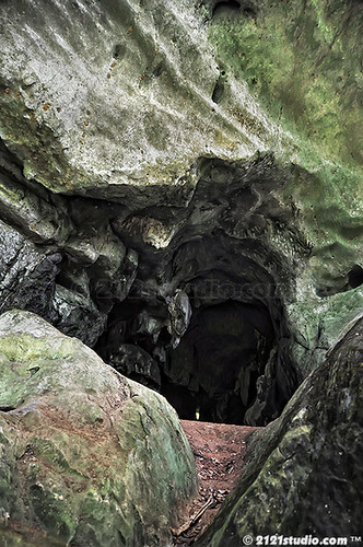
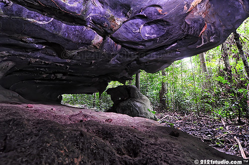
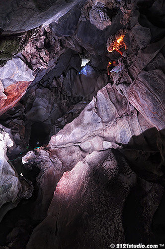
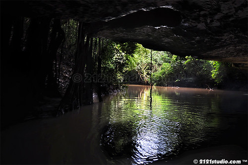
Kawan teloh ke sana selama 3 hari 2 malam. Berikut adalah foto-foto yg dapat kawan abadikan di sana.

Gua-gua dan pemandangan di sepanjang Sungai Kenong..
Image

Sila klik "thumbnails" utk paparan yg lebih besar :

Image Image Image Image Image Image

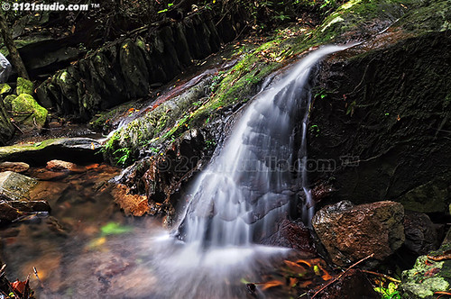
Pemandangan di Lata Babi..
Image

Image Image Image Image Image Image

Sekitar Gua Batu Tangkup.

Image

Image Image Image Image Image Image

Gua Batu Tangga

Image

Image Image Image Image Image Image

Tuesday, March 2, 2010

Mount Rinjani

3733605483_0eeafb7b6f

Mount Rinjani or Gunung Rinjani is an active volcano in Indonesia on the island of Lombok. It rises to 3,726 m (12,224 ft), making it the third highest volcano in Indonesia, and similar in height to Mount Fuji. The first historical eruption occurred in September 1847. The most recent eruption of Mount Rinjani was on 10 May 2009. The volcano had started erupting again on 27 April 2009, and the mountain was closed as the eruptions intensified with plumes of smoke and ash as high as 8,000 m.

3741017963_a0085e0510

The 6 km by 8.5 km oval-shaped caldera is filled partially by a crater lake known as Danau Segara Anak (‘Child of the Sea’) and is approximately 2000m above sea level and estimated at being around 200m deep); the caldera also contains hot springs. The eruptions of 1994, 1995, and 1996 have formed a small cone, Gunung Baru (or ‘New Mountain’ – approximately 2300m above sea level) in the center of the caldera and lava flows from these eruptions have entered the lake. This cone has since been renamed Mount Barujari (or ‘New Finger’).

3741382555_70d991aa0d

The highlands are forest clad and mostly underdeveloped. The lowlands are highly cultivated. Rice, soybeans, coffee, tobacco, cotton, cinnamon, and vanilla are the major crops grown in the fertile soils of the island.

3733535393_28c27b2b63

The volcano and the caldera are protected by a national park established in 1997. Tourism is increasingly popular with trekkers able to visit the rim, make their way into the caldera or even to make the more arduous climb to the highest point; fatalities, however, are not uncommon.  As of July 2009 the summit route was closed due to volcanic activity.

3742201890_4fc1fb33bc